I keep the current and latest NOAA weather radar on my desktop. These are the same maps and radars that the meteorologists use. Controls at the bottom the NOAA pages rock the action or loop it. You can also add the prevailing winds, isobars, and county lines. Very cool!
Atlantic Loop
http://www.ssd.noaa.gov/PS/TROP/DATA/RT/nwatl-ir2-loop.html
Florida Peninsula Loop
http://www.ssd.noaa.gov/PS/TROP/DATA/RT/float-ir4-loop.html
Florida and Gulf Loop
http://www.ssd.noaa.gov/PS/TROP/DATA/RT/gmex-ir4-loop.html
Some local weather links close to home:
University of Florida Weather Station
http://www.phys.ufl.edu/weather/
University of Florida Outdoor Camera at Turlington Plaza
http://www.clas.ufl.edu/netcam/
South of us, Central Florida Weather Cameras:
http://www.wesh.com/skycams/index.html
Some hurricane facts:
In the last century, Florida has experienced 57 hurricanes. I guess that will be 58 by tomorrow.
The costliest hurricane was Andrew in 1992, which came onshore at Homestead, Florida. Andrew did 26.5 BILLION dollars of damage in 1992 dollars.
For a hurricane to form, the water temperature must be at least 80 degrees up to a depth of 150 feet. The Caribbean water temp is now actually 95 degrees.
I don't think we will need to "hunker down" through the weekend. This isn't a fierce storm so all should be well. I don't mind a little inconvenience as long as we don't lose the electricity.
Follow the paths of storms past and present.
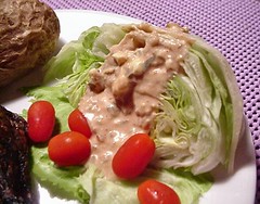
And yes, I did serve W4D a hunk of cardboard last night as promised. I was nice though and made homemade Thousand Island dressing for him. Damned fool liked his salad.
What can I say?


No comments:
Post a Comment